|
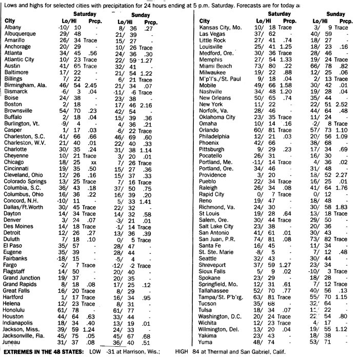
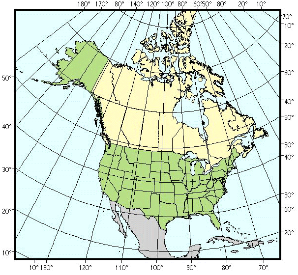
GEOG 332 - Analytical Exercise Maps and Data for Exercise 1Climatic Variability & Weather Dynamics The following maps and data are necessary for this exercise are available at the following links: 1. Table 1 2. Maps and data for January 2 - 3, 1999 4. Map of North America with Latitude and Longitude
Note: The maps and tables linked above have been formatted for convenient viewing on a computer screen and should print reasonably well with the equipment widely available on campus. If you are trying to print from somewhere else in the universe, your mileage may vary. If you have trouble accessing these maps and tables, please contact your instructor: |