Center for Geographic Learning
 The Center for Geographic Learning, established in 1997, is located in the heart of the Department of Geography & the Environment, on the fourth floor of the Humanities Building. The facility was funded by a grant from the National Science Foundation with matching funds provided by the Geography Department and the College of Humanities and Social Sciences. The Center combines a flexible lecture/discussion space with a 30-station networked computer lab.
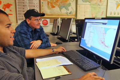
The Center for Geographic Learning is a multi-function, open floorplan instructional space that contains a 30-seat lecture space and a 30-workstation GIS computer lab.
Hardware:
31 Dell Precision 1700 workstations with Intel Core i7 @ 3.40GHz, 8GB SDRAM, 256GB Solid State Drive, 500 GB SATA hard drive, Nvidia Quadro K600 graphics card, 24" monitor, Windows 7 - 64-bit
Software:
Adobe CS6 Design and Web Premium, ArcGIS 10.5 and other ESRI products, Microsoft Office 2013, Adobe Creative Cloud, FRAGSTATS 4.2, SPSS 21
Printers, Scanners, and Plotters:
1 B&W Laser Printer (networked)
1 Color Laser Printer (networked)
1 Desktop Flatbed Scanner
1 Large Format Plotter (HP DesignJet T790)
Typically, GEOG 281 (Map Making with GIS), GEOG 481(Geographic Information Systems: Introduction), and GEOG 485 (Geographic Information Systems: Principles and Applications) are taught in this lab.