Undergraduate Learning Goals
Learning Outcomes
The following five Student Learning Outcomes represent the specific learning outcomes for undergraduate students in the Geography program.
1. Students are able to articulate the definitions of, connections between, and differences among fundamental concepts, models and theories in geography.
2. Students are able to identify and explain patterns and processes of human and physical geography including the diversity of the earth’s peoples and environments, and the interactions between humanity and the earth’s environments.
3. Students can apply mapping and geospatial technologies to analyze geographic data and solve geographic problems.
4. Students can critically assess, interpret, and analyze geographic research.
5. Students can clearly and effectively communicate geographic knowledge and research in writing, orally, and/or visually.
Learning Goals
The Department of Geography has adopted the following statement defining the Learning Goals for the Undergraduate Degree in Geography:
1. Our students enter with a continuum of education needs and graduate prepared to achieve their personal, civic, educational and career goals:
- Their interests reflect the diversity of the discipline
- All students need to be prepared to thrive in a world of shrinking distances and global economies
- Career-oriented students need to have access to courses that prepare them for careers such as planning, environmental analysis, education, and geographic information systems
2. Our students develop the habit of intellectual inquiry and are able to communicate effectively:
- They understand the processes which shape the human and physical earth
- They appreciate the values of intellectual inquiry involving both synthesis and analysis
- They develop skills of observation and measurement needed for geographic inquiry
- They learn to communicate with maps as well as with words and graphics
3. Our students use state-of-the-art technology:
- They learn to solve problems using advanced Geographic Information Systems technology
- They understand the role of the internet for accessing geographic information
4. Our students work effectively in multi-cultural environments:
- They develop a strong global perspective
- They understand the diversity of the earth's peoples and environments
5. Our students work effectively in collaborative settings:
- They experience substantial involvement with small group learning
- They interact with faculty outside of the classroom
Graduate Learning Goals
Learning Goals
The M.A. degree in Geography will:
- Enable students to achieve advanced competency in human geography, physical geography and geographic research techniques
- Provide students with the opportunity to:
- Prepare for advanced study in Ph.D. programs
- Prepare for careers in planning, environmental analysis, GIS and mapping
- Prepare for careers in education including community college teaching
- Provide students with an opportunity to work in multicultural, international and collaborative environments
- Enable students to achieve excellence in research, writing and presentation skills
- Provide students with access to advanced geotechniques
Learning Outcomes
- Students acquire in-depth knowledge of at least one subfield of geography (physical, human, or geospatial techniques).
- Students can clearly and effectively communicate in-depth geographic knowledge and research in writing, orally, and/or visually.
- Students are able to conduct high-quality independent research on geographic issues.
Center for Geographic Learning
Center for Geographic Learning
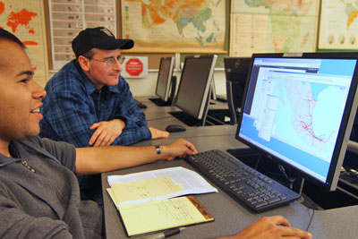
The Center for Geographic Learning, established in 1997, is located in the heart of the Department of Geography & the Environment, on the fourth floor of the Humanities Building. The facility was funded by a grant from the National Science Foundation with matching funds provided by the Geography Department and the College of Humanities and Social Sciences. The Center combines a flexible lecture/discussion space with a 30-station networked computer lab.
The Center for Geographic Learning is a multi-function, open floorplan instructional space that contains a 30-seat lecture space and a 30-workstation GIS computer lab.
Hardware:
31 Dell Precision 1700 workstations with Intel Core i7 @ 3.40GHz, 8GB SDRAM, 256GB Solid State Drive, 500 GB SATA hard drive, Nvidia Quadro K600 graphics card, 24" monitor, Windows 7 - 64-bit
Software:
Adobe CS6 Design and Web Premium, ArcGIS 10.5 and other ESRI products, Microsoft Office 2013, Adobe Creative Cloud, FRAGSTATS 4.2, SPSS 21
Printers, Scanners, and Plotters:
1 B&W Laser Printer (networked)
1 Color Laser Printer (networked)
1 Desktop Flatbed Scanner
1 Large Format Plotter (HP DesignJet T790)
Typically, GEOG 281 (Map Making with GIS), GEOG 481(Geographic Information Systems: Introduction), and GEOG 485 (Geographic Information Systems: Principles and Applications) are taught in this lab.
Center for Remote Sensing and Environmental Analysis
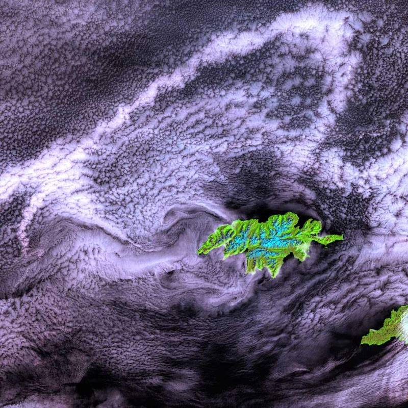 The Center for Remote Sensing and Environmental Analysis (CRSEA), established in 2007, is located adjacent to the Center for Geographic Learning. The facility was funded by a grant from NASA with matching funds provided by the Geography Department and the College of Humanities and Social Sciences. The Center combines a dedicated teaching laboratory with a state-of-the-art research and image processing facility. A variety of remote sensing and image processing software is available.
Hardware:
Data Storage Server
Dual Core Xeon Processor 5130 4MB Cache, 2.00GHz, 1333MHz FSB, 4 GB RAM, 1.8 TB Hard Drive storage.
3 High-End Workstations
Dell Precision T1650 Tower Workstation with Intel Core i7-3770 (8M, 3.4GHz, w/HD4000 Graphics), 8GB RAM, 250 GB Solid State Drive + 500GB HDD, 16X DVD +/- RW SATA, and Dell High Color 30 inch UltraSharp Widescreen Digital Flat Panel.
16 Teaching Workstations
Dell OptiPlex 9010 Minitower with 3rd Gen Intel Core i7-3770 (Quad Core, 3.40GHz, 8MB w/HD4000 Graphics), 8GB RAM, 500GB HDD, 16X DVD +/ - RW SATA, and Dell 20 inch UltraSharp Dual Flat Panel.
Software:
ERDAS Imagine 2013 Full-Suite with ATCOR, ENVI 5.0 + IDL 8.2, ArcGIS 10.5 and other ESRI products, Adobe CS6 Design and Web Premium, SPSS21, FRAGSTATS 4.2, Geospatial Modeling Environment 0.7.2.*RC2
Courses Taught in CRSEA or with CRSEA support:
- GEOG 110 Introduction to the Natural Environment
- GEOG 328 Global Change and Environmental Systems
- GEOG 486 Environmental Remote Sensing
- GEOG 489 Digital Image Processing
- GEOG 520 Seminar in Physical Geography
- GEOG 530T Monitoring Ecosystem Processes
GIS Research Center
The CSUF GIS Research Center is a partnership between Information Technology and the Department of Geography that opened in July 2011. The research center is located on the 4th floor of the Humanities building in H-420B. The GIS Research Center supports teaching and research in Geographic Information Science and Geospatial Analysis at CSUF.

Weather Station
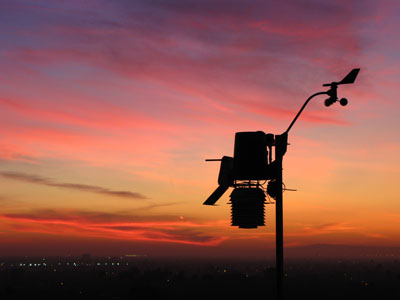
The CSUF HSS weather monitoring station, maintained by the Department of Geography & the Environment, contributes to teaching and research and also serves the wider community. The weather station was installed on the roof of the Humanities and Social Sciences building in September 2009.
Check out the camera's view here: Weather and Air Quality Cam - Campus Cams | CSUF
See the campus' real time weather here: Current Weather Conditions atop the Humanities Bldg at CSU Fullerton
Cal-Dendro Tree Ring Laboratory
 Cal-Dendro is a fully equipped tree-ring laboratory within the Department of Geography & the Environment at California State University, Fullerton. Trevis J. Matheus is the principal researcher of Cal-Dendro. The world needs more dedicated and motivated students trained in field and laboratory research. As a result, we are always looking for new students who are interested in joining the lab or volunteering for field work.
If you are an undergraduate or graduate student interested in joining the lab, email: tmatheus@fullerton.edu
Also, check out our website dedicated to the Cal-Dendro Lab!